Precision Ag
Real-time weather data to aid crop management decisions
A need for accurate, current weather data was the reason behind the development of a new weather system that gives farmers access to real-time information.
The AGGrower Daily Dashboard is powered by a network of 80 weather stations in southwestern Ontario that capture rain fall, relative humidity, and wind speed and direction data minute by minute and push it to a farmer-accessible website every 15 minutes.
Project collaborators AGRIS Co-operative, Wanstead Farmers’ Co-op and Haggerty Creek realized a need among their customers for a web-based, field-specific risk management tool based on real-time weather data.
“We talk about weather so much in agriculture – both the forecast and the weather that just occurred play into management decisions,” explains Dale Cowan, Senior Agronomist with AGRIS and Wanstead Cooperatives. “So we got together and decided to build this network to push real time weather data out to customers. We are trying to make extension advice real-time.”
The dashboard lets farmers plot individual fields and remotely access wind and rainfall data from each station to help make decisions about spraying and nutrient management, as well as establishing crop maturity and insect or disease pressure.
“There’s a lot of management advice that comes with the impacts of weather and the growth stages of the crop. We can predict when tasseling is going to occur, for example, and what management should be considered at that time for plant health and nutrition,” Cowan says.
Interest in the subscription-based system has been high, with uptake varied by what farmers want to know. Rain fall and wind data have been big in 2017. Precipitation has been extremely spotty and then very intense in some regions and wind has made spraying a challenge.
Dave Gillespie grows corn, soybeans and wheat in the Thamesville area. His home farm is a weather station host and he is an avid user of the dashboard. This year, it was particularly helpful in managing spraying.
“Often times I need data when I’m out in the field making minute by minute management decisions and now, instead of just seeing what the predicted wind speed and direction is, I can actually login and see what conditions are being logged on the specific fields,” he explains, adding this lets him react quickly to avoid unsuitable spraying conditions.
“We’ve always known there’s a difference in conditions from here to Ridgetown, but now we know exactly how much the difference can be between two spots that are only 10 to 15 km apart,” Gillespie says.
The collaborators accessed Growing Forward 2 funding for both phases of the project – an investigation into feasibility and execution, as well as the actual implementation, which included establishing the weather stations and working with participating farmers to connect them to the network and get them working with the available data.
“If we didn’t have the funding, we likely wouldn’t have started with this venture at all. It was a great tool for de-risking the venture by having assistance up front to help get it developed,” Cowan says.
This project was funded in part through Growing Forward 2 (GF2), a federal-provincial-territorial initiative. The Agricultural Adaptation Council assists in the delivery of GF2 in Ontario.
November 26, 2017 By Agricultural Adaptation Council
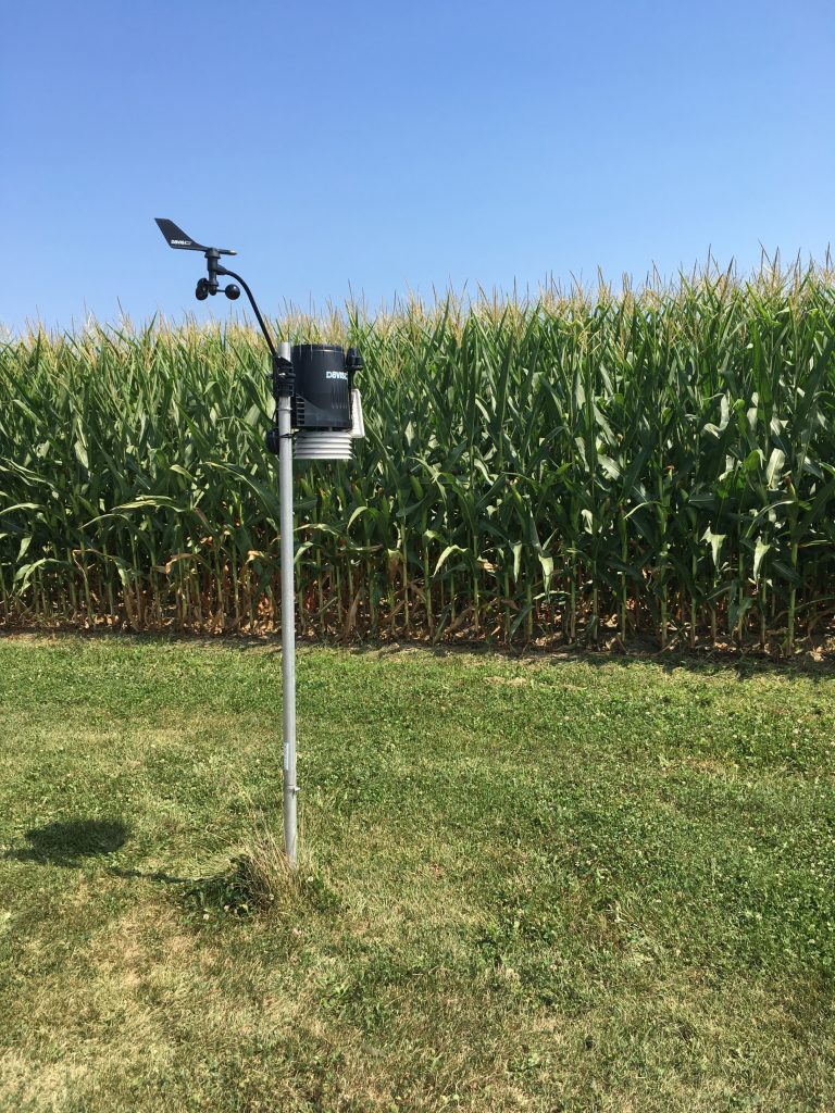 AGGRower Daily Dashboard weather station on the Gillespie farm.